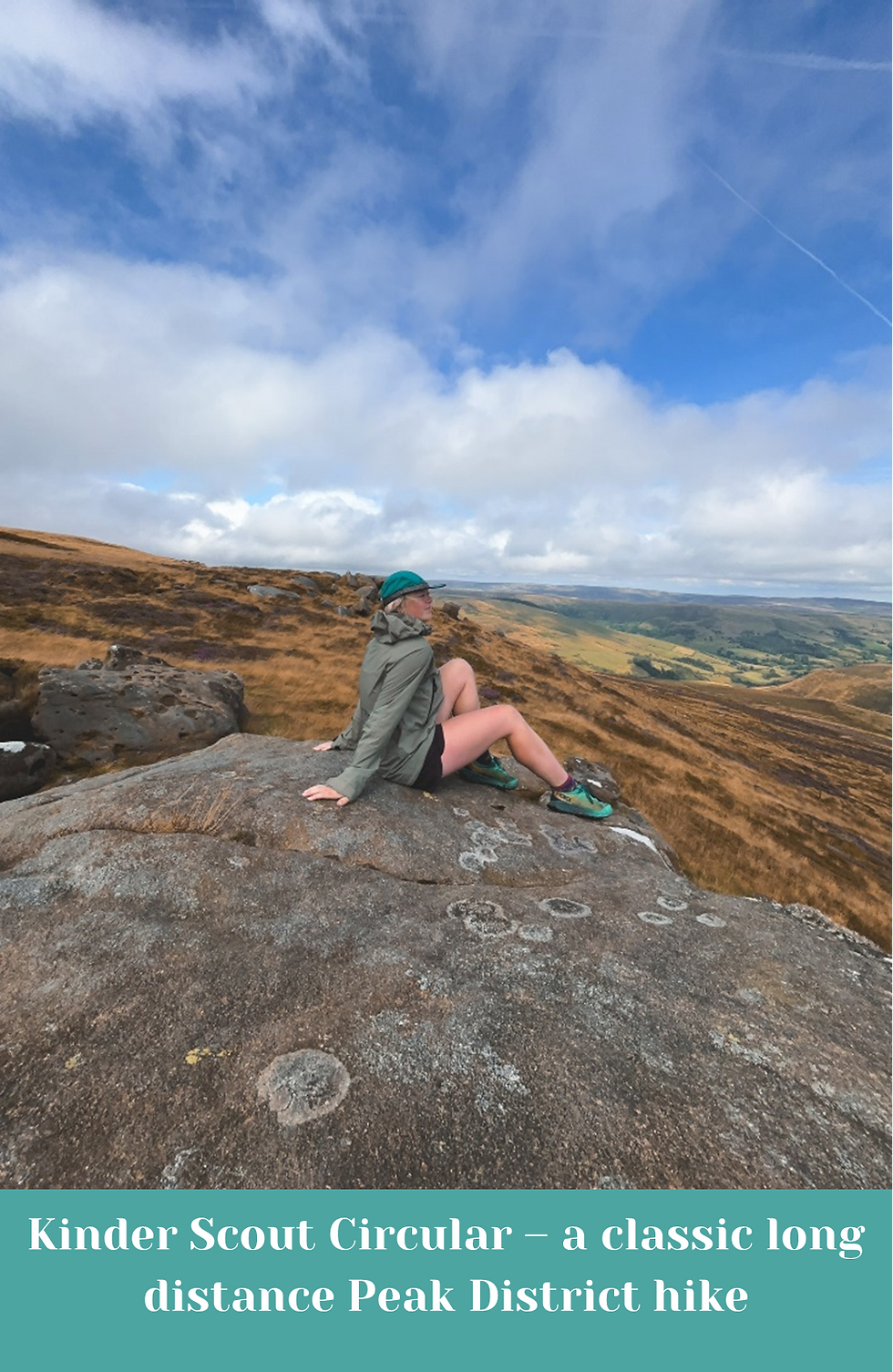
Kinder Scout Circular – a classic long distance Peak District hike
- lottieinthewild
- Sep 5, 2024
- 6 min read
Updated: Oct 9, 2024
The Peak District is such an iconic national park with countless day hikes and incredibly popular beauty spots (hello, Bamford Edge!), but did you know there are several longer distance hikes and challenges here too?
They’re not as well-known as some hikes in the area like heading up Mam Tor or along Stanage Edge, but in my opinion that’s what makes them so great! While these places are beautiful, often the longer hikes in the Peaks link several great spots together, including some lesser known areas making them even more special ..but they’re not for the faint hearted!
I hope to cover a few more of the longer Peak District trails in time!
Contents
What is this hike?
The Kinder Scout Circular does exactly what it says on the tin; it traverses the entire edge of the Kinder Scout plateau. There are several places you can start/finish this hike (I’ve listed a few below) and the base distance you’ll cover is about 16 miles but could be anything up to 20 miles depending on where you start!
The northern edge of Kinder Scout is far less travelled than the very popular routes on the southern edge, and really deserves a day to be explored all on its own! For me, it’s the most beautiful part of Kinder. The views are magnificent, and it just feels a whole lot more remote. It’s the perfect way to enjoy Kinder without the crowds.
Difficulty: moderate
Distance: 16miles+
Duration: 6hrs+
Highest point: Kinder Low trig point 633m / 2077ft
Start/finish: several possible options, see below
Navigating this trail (providing the weather is clear) is super easy. Once you’re on the plateau, decide if you’re going clockwise or anticlockwise and then just keep following it round until you’re back where you began! The trails are clear and easy to follow the whole way round. Some are a little thinner in places but still very obvious. Keep the drop on the same side and you can’t go wrong with this one!
There are many (MANY) rock formations on this hike which are well worth admiring on your way round, or scrambling over if you fancy it! There's an area on the southern side called Woolpacks Boulder Field where the path splits into several and braids its way through. It's a weird and fascinating area to walk through and can often feel like you're going the wrong way. You're not! All paths come together again on the other side.
Side note: the northern edge of Kinder is long and excluding the snake pass inn, there are no villages or amenities in this valley. Not to put you off but if you’re new to the area or a little unsure, it’s just something to consider.
When to hike
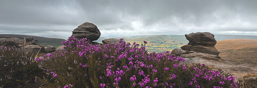
This hike can really be done at any time of year. Every season brings something special but it’s definitely at its best in August when the heather is in full bloom!
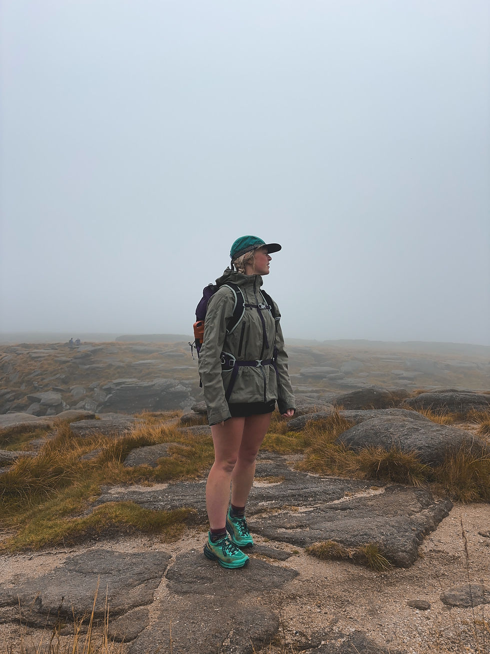
With the route being fairly easy to navigate, it means it’s really quite accessible at most times of year, however there are a few things to take into account. Even in the summer the weather can be gloomy and cloud can roll in thick and fast so it’s always good to be prepared with extra clothing and a map! In winter, if we’re lucky enough to get a dusting of snow the plateau can look magical, but it’s a steep ascent (so take care for icy bits!) and daylight hours are very short.
How long does it take
I’ve done this route a few times now, all starting in different places and each time it’s taken me anywhere between 5 and 8hrs, including snack breaks. I’m quite a quick walker but I do like to stop to take a lot of photos and just gaze around at the view!
The actual walking of this route is fairly easy going once you’re on the plateau but the distance is long so a good level of fitness is still required to complete the whole thing. I would estimate 6hrs+ for the entire circular walk.
Where to start and finish
There are several places to start and finish this walk. The beauty of a circular is that you can start almost anywhere you fancy because you’ll end up back at the same place! I’ve listed a few spots below which are all good starting points and you can download the gpx files at the end!
Hayfield (Bowden Bridge car park)
Starting from just outside of the pretty village of Hayfield, this route goes past Kinder reservoir and up William Clough to the far western tip of the plateau. On a sunny day the reservoir is beautiful and there’s plenty of other paths to discover here too!
Distance: 19.5 miles (31km)
Total elevation gain: 3745ft (1140m)
Postcode for parking: SK22 2LH
Grid ref for parking: SK 04862 86950
Payment: card payment and RingGo
Edale
Edale is a classic spot to start the hike up Kinder, but not necessarily the nicest. There are several different paths up from here so there’s a bit of freedom in that respect! It’s notoriously busy so arrive early to get a parking spot.
Distance: 17.4 miles / 28km
Total elevation gain: 3429ft / 1045m
Postcode for parking: S33 7ZQ
Grid ref for parking: SK 12423 85300
Payment: cash only or PayByPhone
Snake Pass (Pennine Way)
There are large laybys here on both sides of the road for easy access to the Pennine way. This route has the least elevation but is the longest and has a steady climb to where it meets the Hayfield path at Mill Hill. After both paths join, there’s a short steep climb of about 50m to gain the plateau. It can get busy here as parking is free and they serve both the Kinder Plateau and Bleaklow.
Distance: 20.2 miles / 32.5km
Total elevation gain: 2888ft / 880m
Postcode for parking: S33 0BJ (nearest)
Grid ref for parking: SK 08738 92917
Payment: free layby parking
Fair Brook
A pretty way and a steady climb following the stream uphill to join the northern edge of Kinder. Nearer the top the route is a little bouldery in places creating bigger steps but it is a good path the whole way and not in any way a scramble. There are a couple of laybys here, one next to the Snake Pass Inn, and one about 20m further down the road towards Ladybower. The grid ref is for the second layby as it’s bigger.
Distance: 17.5 miles / 28km
Total elevation gain: 3434ft / 1046m
Postcode for parking: S33 0BJ (nearest)
Grid ref for parking: SK 11408 90367
Payment: free layby parking
What to wear
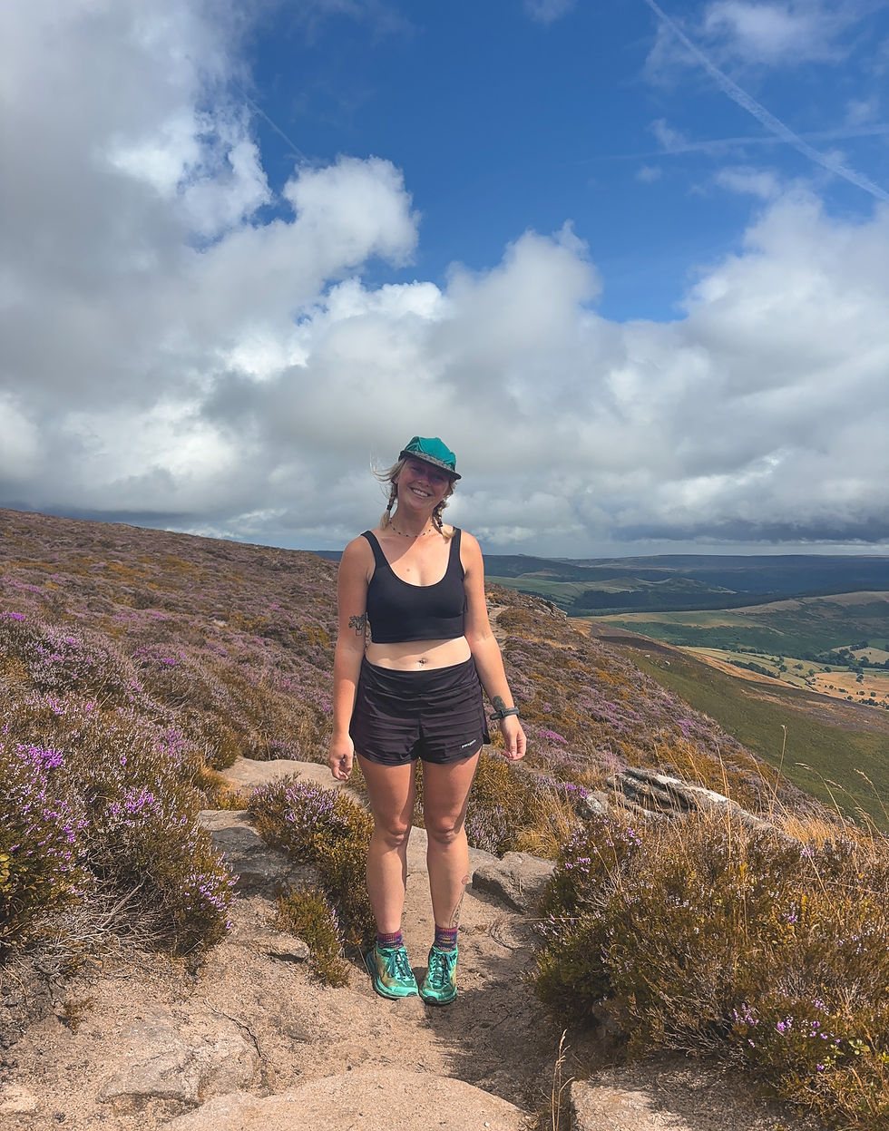
The best and worst thing about hiking in the UK is how changeable the weather is. I did this hike in August and had rain, fog and sun all on the same day ...so it’s best to be prepared. Unless we’re in a dry spell and you really know it’ll just be sunny, I’d stuff at least a waterproof coat in the bottom of your bag, waterproof pants if you can fit them, plus something warm to layer up in. Depending on the season, you might want to take a jacket. Remember, summer evenings can get chilly too and sometimes it’s nice to have a layer when you stop for lunch. (or is that just me?)
For the most part, wear whatever you’re comfortable hiking in! This will largely depend on the weather, and you don’t need top of the range stuff to enjoy getting outdoors but I would always recommend a good pair of shoes. Trail shoes or walking trainers are totally fine for this hike but wear boots if you prefer. A spare pair of socks can be a lifesaver (especially on a long trail) and take up very little room in your bag. Merino socks are fantastic for wicking away moisture which helps avoid rubbing and blisters, but even then I’d always take a spare!
Tip: One thing I personally avoid is wearing cotton t-shirts for hiking, or any exercise for that matter! While it’s great to wear natural fibres, cotton holds on to moisture and takes forever to dry which can cause you to feel a chill especially in unstable UK weather. If it’s a swelteringly hot day it can make you feel clammy for the same reasons!
Packing List - clothes
Shorts/leggings/trousers
Synthetic top
Fleece/mid-layer
Hat (cap or winter hat)
Socks, plus a spare pair
Shoes/boots (whatever your preference)
If you need it…
Coat (down/synthetic/windproof)
Waterproofs (check the weather!)
Sunglasses, gloves (and other seasonal things!)
Packing list - food
Snacks - trail/cereal bars, nuts, fruit etc
Lunch - I personally take things like salami/cheese/flatbread/hummus etc but I’ve also taken leftovers and pizza! Just aim for filling and delicious with a good mix of food groups!
Water - 2/3ltrs for a hike of this length. I never drink enough water but it’s always good to take it with you just in case! If you have a filter there are a couple of places you can refill which have running water even in summer but they’re few and far between; Kinder Downfall and Fair Brook. Golden Clough (by Ringing Roger) also had water in August but please don’t take that as gospel!
Sweets - for fast energy
GPX files


Comments